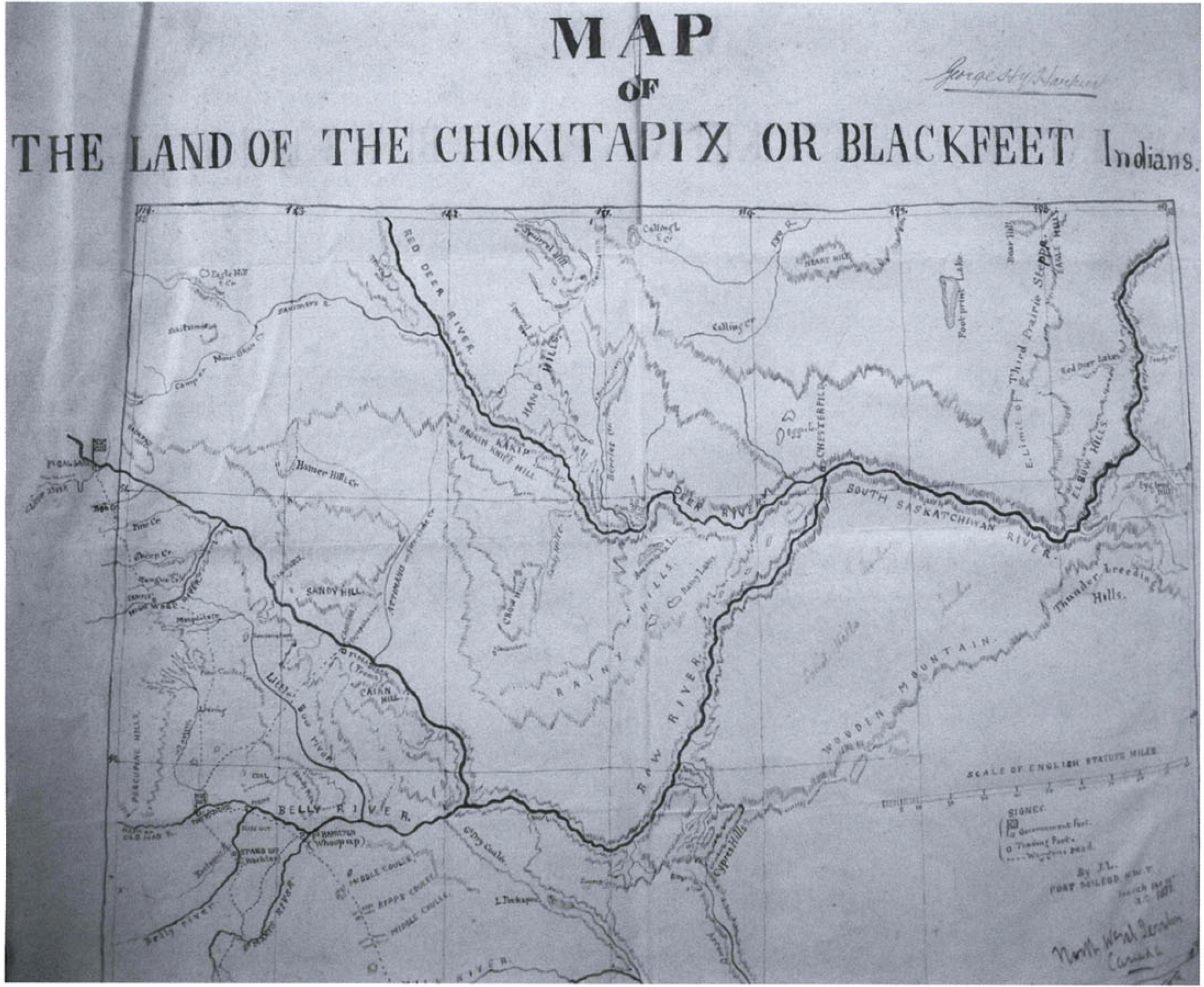
1877 map by Jean L'Heureux, University of Saskatchewan Archives.
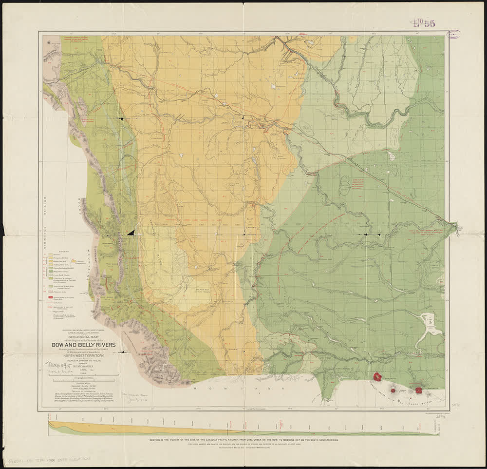
1884 map of the Bow River and its tributaries by George Dawson and colleagues.
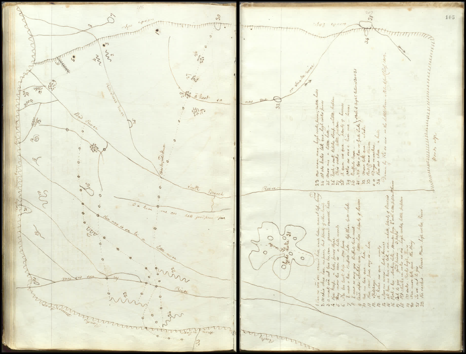
Map drawn by Siksika chief Ki oo cus for Peter Fidler in 1802.
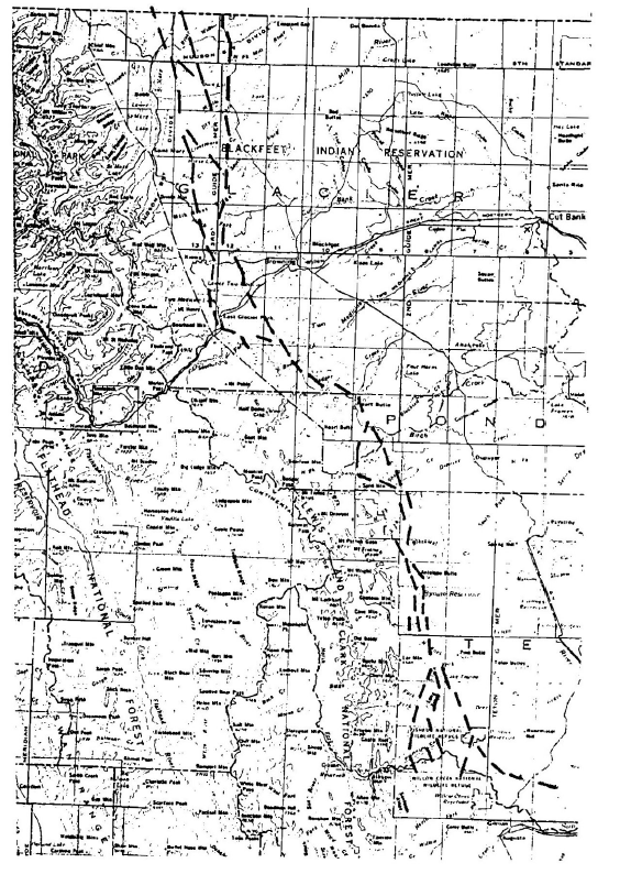
Inner route of the Old North Trail as reconstructed from satellite imagery and archaeological survey.
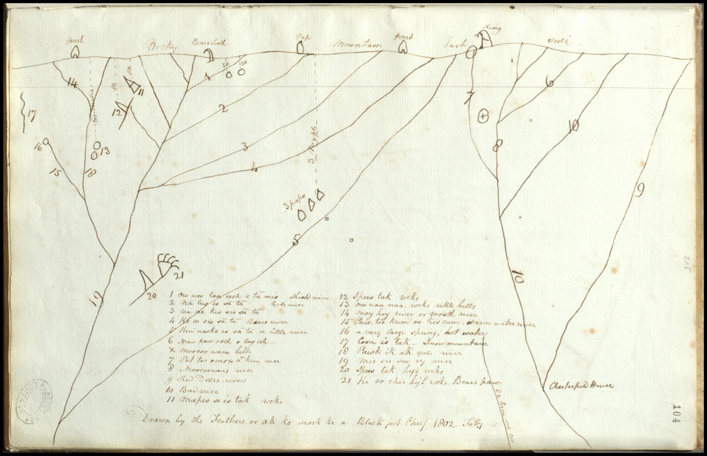
Map drawn by Siksika chief Ac ko mok ki for Peter Fidler in 1802.
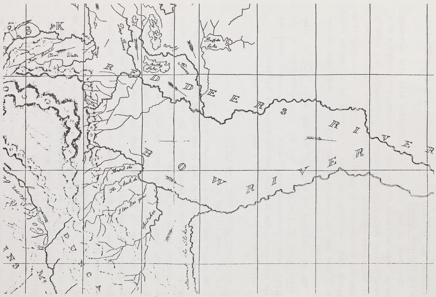
Portion of David Thompson's 1814 "Map of the North-West Territory of the Province Canada from actual Survey During the Years 1792 to 1812"
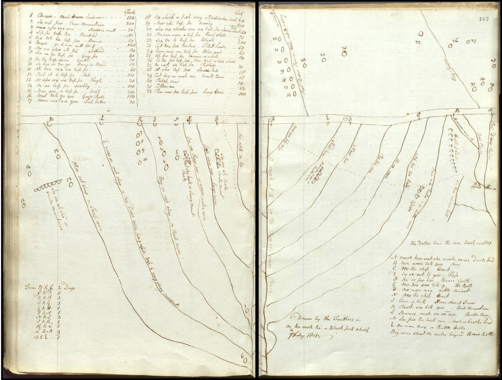
Map drawn by Siksika chief Ac Ko Mok Ki for Peter Fidler in 1801.
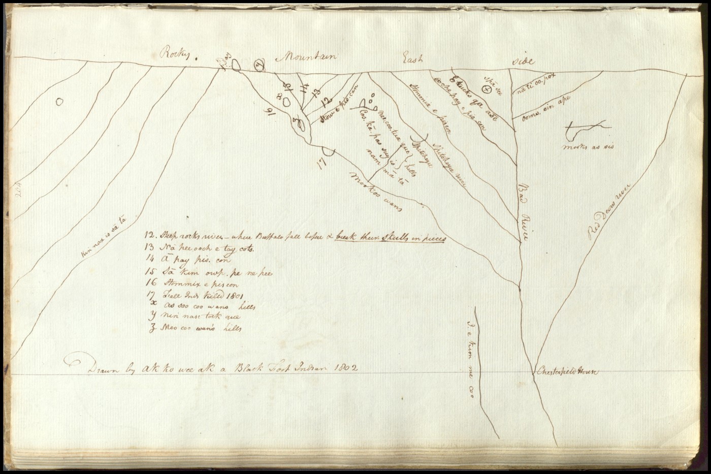
Map drawn by Siksika hunter Ak ko wee ak for Peter Fidler in 1802.